I’ve seen my share of rough weather at sea, but the storm that still visits my nightmares happened about five years ago while I was exploring offshore sailing routes, solo. I was halfway between Tasmania and New Zealand, deep in the watery wastes of the Tasman Sea, when I found a storm that made me fear for my life.
Offshore Sailing Routes in The Southern Ocean
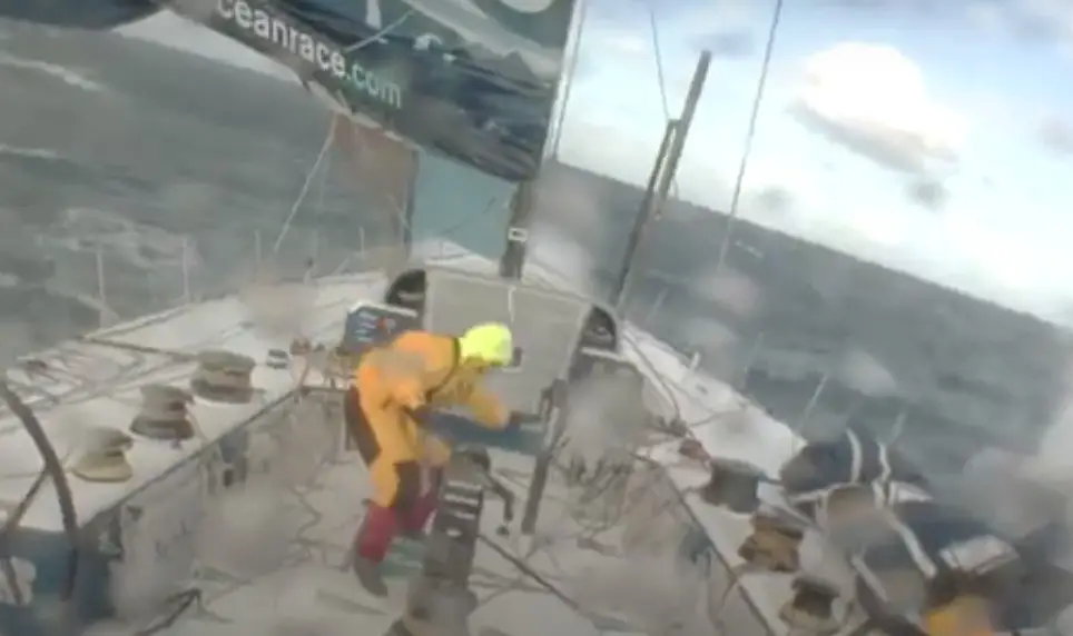
Down there in the Southern Ocean, I expected the 39 foot sailboat I was delivering to be crushed by a massive breaking wave any moment, sending the boat and myself on a one way ride to Davy Jones Locker. We had been knocked down 90 degrees several times, and I was later to discover that the mast had sustained severe damage. It was only by a great miracle that we were not dismasted – the upper starboard shroud had broken off at the top of the mast and if we had been on the opposite tack the stress of the wind and waves on the mainsail would instantly have broken it in two.
I watched through the hatch as a wave ripped off the solar panel from an arch on the stern, just before the wind gusted so high that the wind generator – which had been set to the storm safety setting – spun itself out of control and broke. It never worked again.
The waves were now towering far above the boat, and I didn’t look over at them but rather up.
I had no way to measure the wind speed, because my tachometer had also broken after holding steady on the maximum reading of 60 knots for several minutes. It seemed that both the wind and the waves had worsened considerably since then.
The worst of the storm lasted through a full day and into the night. Then it got worse again. I was grateful that there seemed to be few ships around, because I stopped going outside to make sure none got close enough to run us down.
Hanging On For Dear Life
I didn’t even consider the idea of going on deck and leaving the “safety” of the cabin. Even with my safety harness on, any of the waves that were regularly breaking over the deck and cockpit could wash me over the side and away from the boat. Were the boat to take on too much water and sink, I knew very well that my chances of survival in a life raft in these conditions were little to none. It probably would have blown away in the wind immediately upon inflation anyway, considering the strength of the gusts.
Instead, I curled up into a ball on the cabin floor, held the emergency EPIRB in my arms (so that I could set it off right away if the boat started sinking), and prayed. I also cried a little from the fear and the stress and the lack of sleep.
After three full days and two nights where I was too paralyzed from fear to rest, the conditions finally died down enough that I was able to rest for an hour – my longest sleep in days. Less than a week later, the New Zealand Coast Guard prepared to launch an international search for my vessel. But we will get to that soon enough.
Where Angels Fear to Tread
That storm may have been the once in a lifetime struggle for survival that you hear about at seaside bars, but it was just another day for the Southern Ocean. In fact, this storm wasn’t even a particularly bad storm for that part of the world.
The Southern Ocean
You see, the Southern Ocean is the loneliest, stormiest, and most remote stretch of water on the planet, and conditions here regularly deteriorate to a level that is rarely experienced anywhere else on the planet.
Most early maps of the world simply filled the seas around Antarctica with mystical beasts of the deep or warnings like “here be dragons”. Because so few of the early explorers who sailed here made it back home alive, it was safe to assume that anyone who ventured into this part of the world would most likely get eaten by a giant squid.
In reality, it was the horrendous weather and the dangers of the ice that killed off so many of the early adventurers who braved these waters. And those dangers remain just as bad today as they were centuries before. While most of the world’s oceans have been tamed by technology and tourism, chances are you won’t find a Southern Ocean Boat Club opening business any time soon. Indeed, the Southern Ocean is the last great wilderness left on the planet. If you are looking to get away from society, this is the place to go. And there is no place that embodies the desolation and wildness of the Southern Ocean more than the Five Great Capes.
The 5 Great Capes
Perhaps the famous French solo sailor Bernard Moitessier summed up the Great Capes best. After setting out in 1968 to complete the first nonstop solo race around the world, Moitessier fell in love with the Southern Ocean, dropping out of the race to complete another lap around the world without stopping for rest or supplies. He wrote:
“A sailor’s geography is not always that of the cartographer, for whom a cape is a cape, with a latitude and longitude. For the sailor, a great cape is both a very simple and an extremely complicated whole of rocks, currents, breaking seas and huge waves, fair winds and gales, joys and fears, fatigue, dreams, painful hands, empty stomachs, wonderful moments, and suffering at times. A great cape, for us, can’t be expressed in longitude and latitude alone. A great cape has a soul, with very soft, very violent shadows and colours. A soul as smooth as a child’s, as hard as a criminal’s. And that is why we go.”
Bernard Moitessier
Cape Leeuwin
At only 34 degrees south, Cape Leeuwin, the southwesternmost point of Australia, is the most “tame” of the Great Five Capes (if such a word can be used in the same sentence as the Great Capes). Known as “Doogalup” by the Wardandi Aboriginies for thousands of years, the Cape was re-named Leeuwin by the English navigator Matthew Flinders after a Dutch ship that had previously charted some of the surrounding coastline.
Cape Leeuwin may be the least formidable of the Five Great Capes, but that doesn’t mean that it is easy sailing every day of the year. The Cape is surrounded by dozens of shipwrecks, which is evidence of the dangers involved with sailing around this part of the continent. For the modern day sailor voyaging around the bottom of Australia, rounding Cape Leeuwin marks the beginning of the Southern Ocean, and the foul weather that comes with it.
The official boundaries for the Southern Ocean are 40 degrees south, but for the storms that blow around the bottom of the world, the technical border is more of a guideline than a firm rule. As every sailor who has visited the deep south knows all too well, gales sweep through the area every three to five days, and considering the long distances between safe ports and the rugged and inhospitable coastline, it’s impossible for any vessel voyaging here to avoid the foul weather entirely. Indeed, there is no land to the south of here until you reach the icy shores of Antarctica.
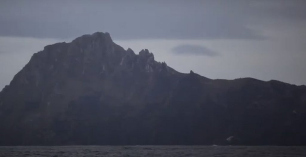
Southeast Cape
1500 nautical miles southeast of Cape Leeuwin is the southernmost point of Tasmania (and all of Australia), a windswept rock known simply as Southeast Cape. The name may not be very awe inspiring, but the windswept cliffs and regular gales that sweep around this cape are. It was here that I got my first taste of a full on Southern Ocean storm, which was to be a preview of the cyclone I experienced a few weeks later in the middle of the Tasman Sea.
Unlike Cape Leeuwin, which is relatively flat as far as capes go, Southeast Cape has high mountains that rise directly out of the sea. This causes winds here to increase in strength as they blow past the cape. Often, the winds are katabatic in nature, a kind of wind that blows down the mountainside of steep fjords or sheer mountain faces. This wild wind, which is fueled by the regular passing of low pressure storms, combined with a quick shallowing of the seas by the start of the continental shelf, causes the seas here to become steep, confused, and oftentimes breaking in conditions that wouldn’t be nearly as bad a few miles farther out to sea.
Navigating Under Sail
When I sailed past here on a yacht delivery from Adelaide to New Zealand, the sea gods decided to give me a solid taste of all these factors all at the same time. Of course, my engine also happened to be out of commission, so I was forced to round the cape and sail into a nearby port entirely under sail – just like the sailors of old on the clipper ships. Unfortunately, unlike the Clipper captains before me, I had to operate my vessel without any crew to assist with the sails, navigation, steering, watching out for other ships or anchoring.
The conditions for the past four days had been bad enough for the vessel to require near constant attention, and my fatigue at that point was beyond comprehension for anyone who hasn’t sailed alone in the Southern Ocean. I knew from experience that one more night out here and I would be hallucinating.
The seas threatened to knock down the boat every few minutes. The gale was forecast to get even worse, so I knew that there was no point in heading for open water to wait it out. Against all my better judgment and professional training I decided to bite the bit and sail for Port Arthur.
I made it, just barely. As I sailed through the narrow entrance under storm trysail, the waves exploded on the rocks located on both sides of me. The windlass was also broken, so I heaved the anchor over by hand, waited a few minutes to make sure that it was set, and fell asleep.
I didn’t wake up for over seventeen hours.
Southwest Cape
Southeast Cape’s twin cape in New Zealand, if you will, is Southwest Cape. Southwest Cape is located at the very southern tip of Stewart Island, the small island located at the far southern tip of New Zealand, which has been made famous around the world as one of the last refuges for the much loved Kiwi bird. Stewart Island is even farther south than Tasmania, and is the Great Cape located closest to Antarctica, except for Cape Horn.
Some sailors who are circumnavigating the world by way of the Southern Ocean choose to sail around New Zealand farther north, via Foveaux or Cook Straits, or even north of the North Island of New Zealand. These routes have challenges of their own, but sailors who choose to sail this way are not truly circumnavigating via the traditional Five Great Capes route. Some sneaky sailors, looking for an easier way to set a record, sail around the world via Torres Strait and end up spending most of their voyage in the trade winds. After a few months in the icy wastes of the Southern Ocean, it’s easy to see why.
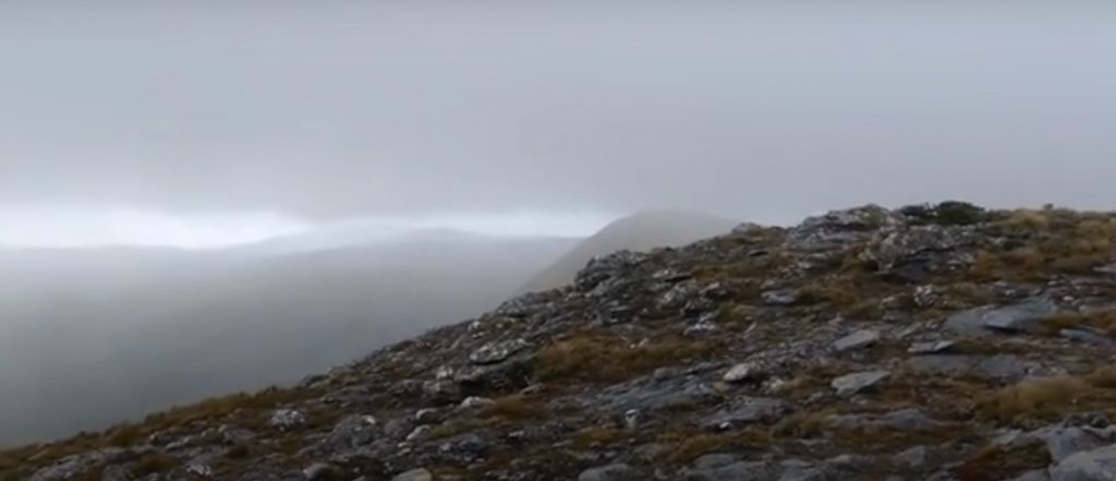
Sailing Without Wind
It’s usually blowing a strong wind around Stewart Island, but as I finished my voyage across the Tasman Sea, I had the opposite problem. The wind died altogether, and without a functional engine I ended up becalmed off of South Island’s Fiordland for a few days. After months of one gale after the last, it was a welcome respite. A few days later a light wind picked up, and I was able to take advantage of the fluctuating wind and tides to make my way to Bluff, the southernmost town in New Zealand.
I got there just as the Coast Guard was preparing to launch a Tasman wide search for my vessel. I had been in touch with friends and family via satellite communications, but apparently the authorities in New Zealand didn’t get the word that I had been delayed by the gales and the calms. The Tasman is famous as the graveyard for many highly skilled navigators, and when a boat doesn’t arrive on time, people quickly assume the worst. Fortunately, I arrived just in time and got cleared into the country with only a testy warning about local radio procedure and a finger waved in my face.
The Cape of Good Hope
Although the Cape of Good Hope is, like Cape Leeuwin, located far north of the official boundary of the Southern Ocean, this cape may be the most complicated of them all in terms of weather and sea state patterns. This cape was originally named the Cape of Storms, a much more appropriate name given it’s reputation, but it was later changed so as to not discourage sailors who had already fought the sea for months to reach this point.
It’s often said that Good Hope is the southernmost point in Africa, but that honor actually belongs to Cape Agulhas, 90 miles to the southeast. Cape Agulhas may be farther south than the Cape of Good Hope, but all the beauty and fame go to the “Cape of Storms”. It is here that the legendary Flying Dutchman is said to forever fight the wind and waves, trying but never succeeding in making it around the damned cape.
The Flying Dutchman
The Flying Dutchman may be a legend, but I’m sure that many a passing sailor felt the curse applied to them while trying to make their way around the bottom of Africa. This stretch of coast is notorious for stalling ships on their way around the world, or ending their voyage prematurely, as many thousands of ships discovered after coming to grief on the rocks.
The worst conditions develop here when the west flowing Aghulas current collides with an opposing wind coming from the Southern Ocean. When this happens over the shallow continental shelf, the seas can get so bad that commercial freighters have been known to break in half. Fortunately, with modern weather forecasting and various ports available to seek shelter, it is now possible to avoid the worst of the weather with some skill, patience and a little luck.
Cape Horn
The Cape of Good Hope has a well earned reputation, but Cape Horn is undeniably the Everest of the oceans. With the most inhospitable lee shore in the world in Chilean Patagonia to the north, and the Drake Passage (unanimously agreed upon by sailors to be the most stormy stretch of water in the world) to the south, Cape Horn is not an easy place to get to.
Over the centuries of sail, over 10,000 sailors died trying to round the famous cape, and it’s easy to see why. Antarctica is only a few hundred miles to the south, although only the most fearless sailors on the seas are crazy enough to turn south here.
It is said that south of 40 degrees there are no laws, south of 50 degrees there is no God. Nobody has yet decided what is south of 60 degrees, except to call them the “screaming 60’s”. It was in this frozen wasteland that sailors like Shackleton, Moitessier and Knox-Johnston battled their demons and made their way into the history books.
Tierra del Fuego
At 56 degrees south of the equator, Cape Horn is located far below the other Great Capes. The cape is actually a small island located south of the larger island called Tierra del Fuego (which means the land of fire, named after the huge bonfires that the natives here burned in order to ward off the extreme cold). Tierra del Fuego is split between Chile and Argentina, although Cape horn itself lies entirely within Chilean territory.
Here, the same storms that blast the other capes get squeezed into the relatively narrow area between the Patagonia and the Antarctic Peninsula, making them carry more force than in the other parts of the ocean. Because Cape Horn is the only large landmass that extends this far south, many of the storms here have literally circumnavigated the entire globe by the time they hit Tierra del Fuego.
For most sailors on a round the world voyage or yacht race (such as the famous Vendee Globe), Cape Horn marks the pinnacle of their sailing voyage. Like alpinists reaching the summit of Everest, this both the climax of their voyage and their turning point towards home. For sailors heading back toward Europe, the conditions usually improve dramatically soon after rounding the Horn. Within days they are making their way up the South Atlantic and are on their way into warmer seas and more livable conditions.
Once these brave adventurers are gone, the seas off Cape Horn are left alone for the wandering Albatross, which are said to bear the souls of the sailors who died attempting to round the greatest cape of them all.