I can remember quite clearly when I first decided that I wanted to sail around the world on offshore sailing routes. I was five years old, and my parents had taken me to visit the boat show in the Tacoma Dome for the first time. Within minutes of our arrival, I had already made friends with a boater who was displaying a self-built sailboat he had sailed all over the world.
I climbed into the cabin with my little brother and decided that a boat wasn’t a bad place to call home. Later that day, I had already begun to draw a design for a boat of my own and I had traced my future sailing route around the world with a green crayon in my father’s atlas.
Twenty three years later, I am writing these words as a licensed yacht delivery captain with 65,000 nautical miles (NM) of offshore sailing routes under my keel. My profession has allowed me to sail all over the world – from Greenland to the Southern Ocean and many places in between.
I still have yet to close a circle around the world, but I have a heck of a lot of experience planning offshore sailing routes across the oceans.
When you make up your mind to sail into the sunset, the endless possibilities of potential sailing routes can seem overwhelming. I have written this guide to help you decide what sailing routes to choose and to give you a solid understanding of them so you can carve your own watery wake into the great blue beyond.
Trans-Atlantic Offshore Sailing Routes
Every year there is a great migration of ocean-going sailboats crossing the Atlantic from Europe to the Americas. The vast majority of these boats are traveling between the two most popular cruising destinations in the world – the Mediterranean and the Caribbean.
The ideal time of year to cruise the Med is in the summer, when the water is warm and the sun is shining. If you are planning to cross from the Med to the Caribbean, it’s best to plan to get to the Strait of Gibraltar by early fall.
For people who plan to depart from Northern Europe, it’s a good idea to make sure to give yourself plenty of time to get to Southern Spain or Portugal before the weather gets ugly in October or November.
For the purpose of this guide, we will discuss crossing the Atlantic from the most popular port of departure in mainland Europe – Gibraltar. Here you can wait for the ideal weather window to sail the 700 NM to the Canary Islands.
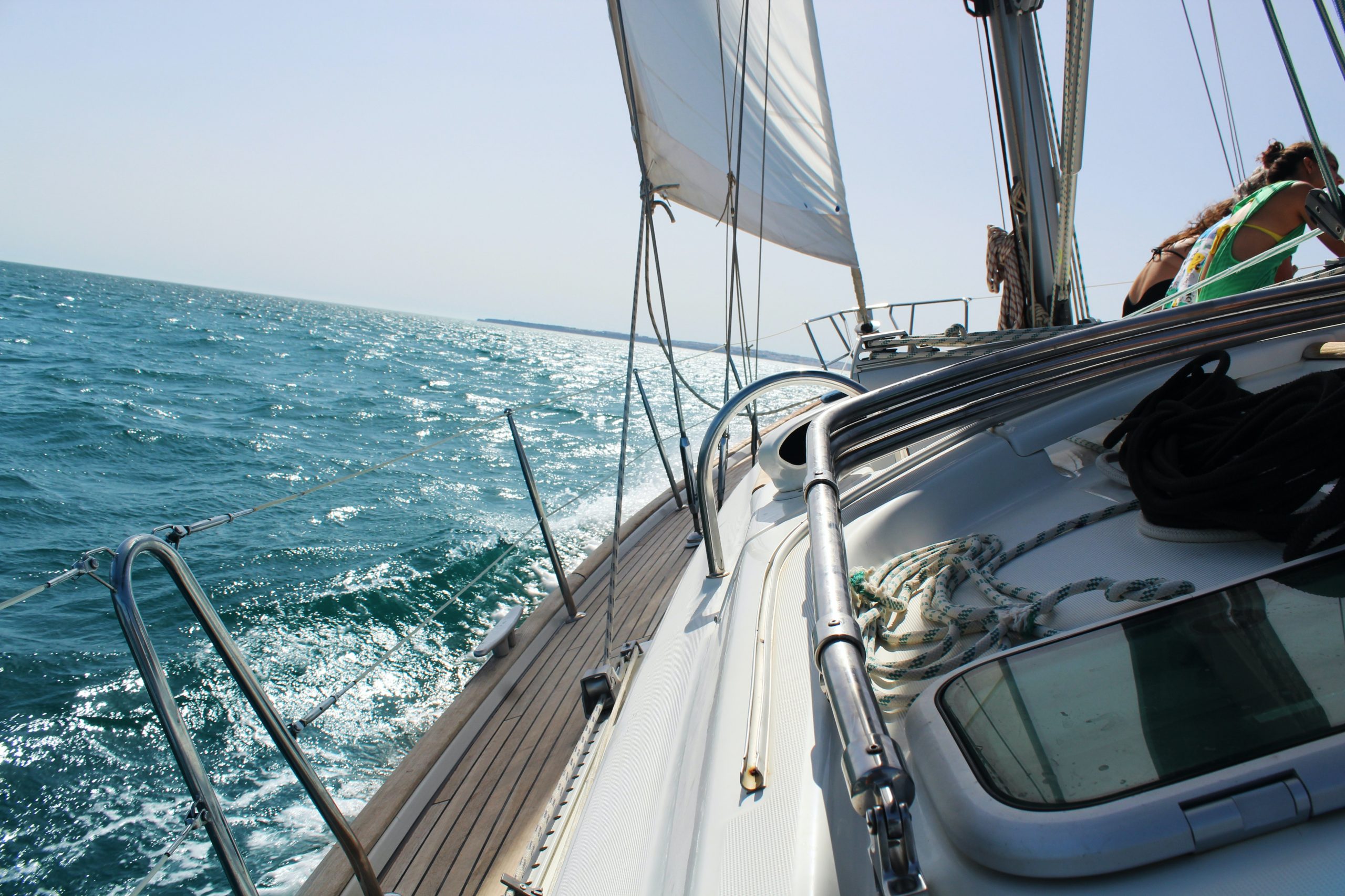
A typical cruising vessel should easily be able to make this passage in five to seven days, even faster if the Portugese trade winds give you a boost. Most of the time, this is an easy downwind sail which will provide you an opportunity to see how your vessel and crew handle offshore sailing before the much longer passage ahead.
The Canary Islands
The Canary Islands are a perfect place to solve any issues that come up on the passage from Gibraltar. Here you can rest, reprovision and make your final preparations for the crossing to the Caribbean. Even Christopher Columbus spent several weeks here topping up his water and supplies before sailing into the unknown on his first voyage to the Americas in 1492.
The Cape Verde Option
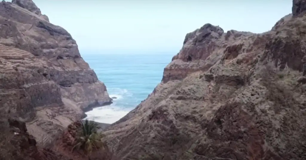
You may choose to make a detour to the Cape Verde Islands 800 NM south of the Canaries. Stopping here can add a few hundred miles to your crossing, but some sailors decide to stop here in order to take advantage of stronger trade winds further south. It’s also a beautiful cruising ground of its own – well worth the extra miles for the adventurous sailor.
Crossing the Atlantic
The sail from the Canaries to the Caribbean is about 2700 to 3000 NM depending on your routing and your port of arrival. The average cruising vessel should be able to make this crossing in under three weeks.
For many of the sailors departing Europe for the Caribbean, the passage from the Canary Islands to the Caribbean is their first long-distance offshore passage. It can seem daunting to someone who has never spent much time away from the security of land.
But fear not – the passage from the Canaries to the Caribbean is downhill all the way! This passage is famous for consistent trade winds, and the prevailing weather will push you all the way to the Caribbean. Ocean-going rowboats choose a similar route to cross the Atlantic because of the favorable winds and currents. This passage has been successfully completed by a six foot boat, a liferaft, and even a man in a dinghy who left port without food or water. Sailors in a well found and properly prepared seagoing yacht should have no problem.
When to Go
To take advantage of the best weather you need to leave between December and April. Early winter is best as it gives you the most time to find a safe place to keep your vessel before hurricane season begins in June.
Under no circumstances should you try to make this passage during hurricane season. Even during the winter, you will want to watch the weather carefully and consider the use of a professional weather router to help make your crossing as safe and enjoyable as possible..
Keep in mind, even in the right season the sailing can sometimes get exciting. Squalls (a kind of localized storm with strong wind and rain) can strike with little notice. Always keep an eye on the horizon and be ready to reef the sails quickly if necessary.
Life At Sea
Once the trade winds set in and the crew have adjusted to life at sea, it’s time to enjoy one of the most beautiful places in the world – the open ocean. Out here there is no rush hour traffic or pollution. You don’t need to worry about work deadlines or bills. You can’t spend too much money even if you want to because there is nowhere to spend it! Personally, I find offshore passages like this to be one of the most enjoyable aspects of the cruising life.
Instead of blowing money, you get to spend your days reading and writing, keeping watch for birds and dolphins, trying to catch a mahi-mahi or tuna, and learning how to bake bread at sea. You are in one of the few places left in the world where you don’t need to check for emails or phone calls every twenty minutes. You are an oceangoing sailor and thus one of the luckiest people alive.
Like they say, it’s a tough job, but somebody’s gotta do it.
Before you know it, three weeks will have passed and you will be scanning the horizon for the first glimpse of a paradise island in the Caribbean.
Planning for a return passage to Europe from the Caribbean is a little more complex. We will discuss this route in further detail in the next section. .
Atlantic Circuit Offshore Sailing Routes
In the next three sections, we will explore sailing circuits of the Atlantic, the Pacific, and the Caribbean. This is a great option for sailors who want to take a year off to sail offshore and see much of the world, but don’t quite want to commit to a round the world sail. We will begin with a one-year sailing circumnavigation of the North Atlantic from the East Coast of the USA.
The ideal time to cross the North Atlantic is between March and May, depending upon your port of departure (Unless you are crossing the far north via Newfoundland, Greenland, and Iceland, which is better done between June through August.). This is when the rough winter weather starts to die down, but before the risk of hurricanes begins in June.
If you make this crossing later in the year you will need to keep a very close eye on the tracks of tropical storms. Fortunately, this sailing route is near the end of their trajectory, which means by the time most tropical depressions get this far they have been on the radar long enough to get out of the way.
Early in your passage, you will have to traverse the Gulf Stream current. If you watch the weather this shouldn’t be a problem, just make sure that you don’t cross on a day when the wind is blowing against the current. Then the seas can get quite dangerous.
Bermuda
Bermuda is less than a week’s sail from most ports on the East Coast, and makes an excellent port of call on the way across the Atlantic. Rest and reprovision in Bermuda for a few days (or a few weeks), and when the weather report looks good you can depart for the Azores.
The Azores
The Azores are 2,000 NM to the east, and it should take most boats two to three weeks to get there. As you make your way east, be careful to watch the position of the Azores High. If you are lucky, you will be able to sail north of it and get consistent winds the whole way across. If you get stuck in the middle you may find yourself motoring for much of the passage.
From the Azores it’s 900 miles to Gibraltar, an excellent first stop in mainland Europe and the gateway to the Mediterranean. If you arrive in Gibraltar by May or June, you have the whole summer to cruise the Med.
Mediterranean
You now have the entirety of Southern Europe to your disposal. Some cruisers will want to stick to the Western Med and thoroughly explore Spain and Southern France. Others may choose to put their boat up in a marina and enjoy an overland tour of the continent. Personally, I am extremely tempted to cruise the Greek Islands and the coast of Turkey before wrapping up my Meditteranean sail with some off-the-beaten-track side trips to Northern Africa or the Middle East.
Regardless of how you choose to spend your summer in the Med, you will definitely want to make sure to be back at the entrance to the Strait of Gibraltar by September or October. Then you are in the perfect position to safely complete your transatlantic sail to the Caribbean (described in the previous section, Trans-Atlantic Sailing Routes).
If you leave the Canary Islands in December, you should have three or four months to enjoy the Caribbean before closing the circle on the East Coast USA. Just make sure to be safely home before hurricane season in June.
Trans-Pacific Offshore Sailing Routes
Every year, about 400 cruising sailboats leave Panama, Mexico or the West Coast of North America for the “Coconut Milk Run” (Milk Run) or the “Pacific Puddle Jump” across the Pacific. This route is called the Milk Run because it is considered easy when compared to rounding Cape Horn or sailing through the Southern Ocean.
Departing From US West Coast
Cruisers who sail directly from the US West Coast have various weather patterns to keep in mind. Those departing from the Pacific Northwest will want to sail down the coast of Washington, Oregon and Northern California between May and October. I have made the passage down the coast in the winter, and I wouldn’t recommend it for anyone but highly experienced sailors on bulletproof boats.
Once south of Point Conception, the weather becomes much nicer, even during the winter. If you are planning to sail to French Polynesia, you can choose one of three options:
1. Sailing directly from California to Polynesia in the winter.
2. Keeping the vessel in California until the following spring and departing for Polynesia in March or April, or…
3. Cruising Mexico through the winter and making the puddle jump in the spring.
Most sailors choose option 3.
Hurricane Season
When sailing from the West Coast to the South Pacific, you need to keep in mind two different hurricane seasons. The first is the North Pacific Hurricane Season, which lasts from June until November, and the other is the South Pacific Cyclone Season, which is between November and May.
The schedule for most sailors is to make the crossing some time in March or April while the North Pacific is clear of storms, arrive in French Polynesia in April or May, and cruise the South Pacific until November.
Cyclones
The possibility of encountering a cyclone in French Polynesia is much lower than further west in the South Pacific, so some cruisers keep sailing through the year. In between 1969 and 2010, there were thirteen cyclones recorded in or near French Polynesia. In the same period of time, 286 such storms were recorded in the North Atlantic region. Clearly, the chance of encountering a cyclone in French Polynesia is much lower, but the risk is still very real.
It’s about 3,300 NM from California directly to the Marquesas Islands (the first stop in the South Pacific for most cruisers), which should take most boats about three to four weeks.
Inter Tropical Convergence Zone (ITCZ or the Doldrums)
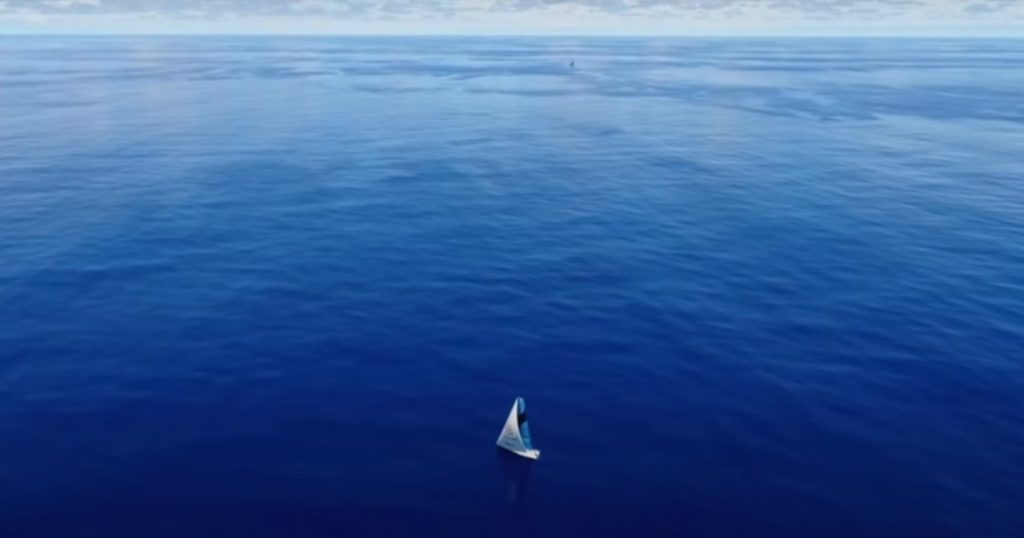
This passage is a little more complicated than the Atlantic crossing in the previous section because you will be transiting the Inter Tropical Convergence Zone (known among sailors as the ITCZ or the doldrums). The ITCZ is an area of variable winds in between the NE trade winds in the Northern Hemisphere and the SE trade winds in the Southern Hemisphere. Here, you can have days (or weeks) of little to no wind, punctuated by sudden, violent squalls which seemingly come from nowhere and typically last less than an hour. It’s also extremely hot and humid.
I once spent eighteen awful days in the ITCZ, during which I covered less than 200 NM. It was my slowest speed record of all time, but when I feel bad about my progress, I have to remind myself that year was the worst El Nino in recorded history, and I was aboard a 27 foot boat with no engine.
With a little luck, and the help of an iron genny, (sailor-speak for engine) you will be back in the trades in 3 to 5 days. Once you break through the ITCZ, it’s a relatively short reach through the SE trade winds to the Marquesas.
Departing From Mexico
If you choose instead to depart from Mexico, you will want to plan to depart Southern California in late November and cruise Mexico through the winter. In the spring, you will make a very similar passage as those who left directly from California, but it will be a significantly shorter trip.
The best sailing conditions are usually encountered if you depart from Cabo San Lucas or Puerto Vallarta. Further south, you have a greater chance of light winds and more time getting across the ITCZ.
Departing From Panama
Sailors who leave from Panama will want to plan to be through the Panama Canal by December or January. Fortunately, the region between Panama and the Marquesas is not affected by tropical storms.
Many cruisers choose to stop in the Galapagos Islands on the way to the South Pacific. This offers an excellent opportunity to see exotic wildlife and search for the ghost of Charles Darwin, but keep in mind the strict cruising restrictions and the high cost of permits to visit these areas.
It’s about 850 NM directly from Panama to the Galapagos Islands, but you will most likely end up sailing over 1,000 NM. The first half of this passage is against the Humboldt Current, which is one of the strongest ocean currents in the world. This is the cold water that flows up the west coast of South America, and it’s the reason that there are penguins on the Equator in the Galapagos. It also makes for a very challenging first few days out of Panama.
The best way to manage this passage is to motor-sail directly south along the coast of Colombia and Ecuador until you are past the Equator. Then turn west, and you will be sailing across the prevailing winds and currents the rest of the way to the Galapagos Islands. By the time you get to Darwin’s old cruising ground, the wind and current will be behind you. The remainder of the sail to French Polynesia should be a downhill sleigh ride.
The distance from the Galapagos to the Marquesas is about 3,400 NM. This is often the longest nonstop passage that sailors will make in the Pacific. It’s a long trip, but it’s downwind the whole way and you don’t have to worry about crossing the ITCZ, so most cruisers enjoy this leg of the voyage.
West from French Polynesia
Once you get to the Marquesas Islands, you are in the heart of one of the most loved cruising grounds anywhere in the world. From here onward the passages are much shorter and you shouldn’t have to sail more than a week in between landfalls until it’s time to leave the South Pacific.
Most cruisers choose to spend at least six months cruising through French Polynesia, the Cook Islands, Tonga, Fiji, Vanuatu and New Caledonia before finishing in New Zealand, Australia, or hauling out their boat and flying home for the cyclone season.
A few brave cruisers choose to sail back to North America by way of Hawaii or the Great Circle route via Japan and Alaska. But it’s no easy task to sail eastbound across the Pacific.
One popular alternative is to hire a yacht delivery captain to bring your vessel back home for you. But some cruisers who have made it this far realize it’s actually easier to just keep sailing – all the way around the world.
Pacific Circuit Offshore Sailing Routes
For sailors who are based on the West Coast who want to experience a voyage similar to the North Atlantic circuit, an excellent alternative is a one year sailing circumnavigation of the Eastern Pacific Ocean.
If you are departing from the Pacific Northwest, you will want to sail down the Pacific Coast to California before the end of September for the most favorable weather. Keep in mind that all of the ports of the Pacific coast of Washington and Oregon are river bar crossings, and thus can only be safely entered when conditions are calm. If you get stuck out in a nasty blow it’s much safer to stay offshore than to try and cross a river bar at the wrong time.
Weather by Location
I’ve seen my share of bad weather at sea, but the scariest waves I have ever seen were while trying to cross Grays Harbor Bar (In Southern Washington) as an unexpected gale was building in mid-winter. I don’t know the height of the waves, but needless to say, I won’t try that again any time soon!
If you make it to Southern California by the end of September, you have two months to relax before the season begins to sail down the coast of Baja California. Your options are to cruise Southern California, put up your boat in a marina and explore inland for a few months, or cross the border and wait in Ensenada, Mexico.
Personally, I would choose to wait in Ensenada, which is home to Marina Coral, one of my all time favorite marinas in the world. Marina Coral is complete with it’s own hotel, restaurants, showers, swimming pool, spa, and jacuzzis and it’s a perfect place to begin the good life south of the border. There is also a free daily shuttle to the customs office downtown.
In late November, it’s time to begin your Mexican cruise. After the one week passage to Cabo San Lucas, you have the choice of either heading north into the Sea of Cortez or sailing directly over to Puerto Vallarta and cruising the Mexican Riviera until it’s time to make the crossing to French Polynesia in March or April.
We discussed the crossing from Mexico to French Polynesia in the “Trans-Pacific Sailing Routes” section above. If you arrive in the Marquesas in April, you should have three months to cruise French Polynesia before it’s time to turn north toward Hawaii. Plan on leaving for Hawaii by early July.
Planning for the Weather
The next legs of this voyage require more careful planning with the weather. In order to have enough time to cruise Polynesia, you will need to make the sail north to Hawaii during hurricane season.
This time of year, it’s only north of the Equator where there is risk of encountering a hurricane. For this reason, I like to make a stop at Christmas Island, Kiribati on the voyage between Tahiti and Hawaii. This will allow you to reassess the weather situation before the final leg to Hawaii, and will give you the opportunity to explore a fascinating remote island that few people get to visit.
The hurricanes that pose a risk on this passage usually develop in the Gulf of Mexico with many days warning before making it this far west. So get a solid weather report in Kiribati, and once the coast is clear you can head north toward Hawaii.
The first two or three days out of Kiribati are through the ITCZ, so it’s a good idea to take advantage of the light wind to motor NE instead of due north. This will give you a better sailing angle later on in the passage.
Hawaii- Pacific High
You should plan to arrive in Hawaii by mid to late July to rest up for a few weeks and prepare for the final offshore passage of your Pacific circuit. Just like the passage north from Tahiti, prior to departure from Hawaii you will want to make sure that the coast is clear for tropical depressions that could affect your route.
Regardless of your destination on the West Coast, when you cross from Hawaii to the mainland you will need to sail around the Pacific High. This means sailing due north for the first week or so out of Hawaii. The position of the high will determine how far north you need to sail before turning east. If my destination is California, I usually sail to about 40 degrees north before turning east and if I am headed to Washington State or British Columbia I sail to 45 degrees north.
If the Pacific High is located further south, you may need to motor through light winds for 3 or 4 days. If you are lucky, you will be able to sail the whole way, but make sure to bring enough fuel in case you get stuck. I like to leave Hawaii with enough fuel to motor for 1,000 NM, and I have always had enough for the entire passage.
If you are feeling adventurous, a detour to Alaska can make an excellent grand finale to your one year sailing sabbatical. By sailing directly north from Hawaii, you may even be able to avoid the Pacific High altogether and finish your circuit with a coastal cruise down the beautiful Inside Passage.
Caribbean Offshore Sailing Routes
Another option for cruisers with limited time is a six or seven month clockwise circuit of the Caribbean Sea. This route offers sailors the unique opportunity to visit more than two dozen countries on their own boat without making a single long distance ocean crossing. The longest passage you should have to make on this route is under one week, so this route is a good choice if long offshore passages aren’t your thing.
Departing Florida in November, you can begin your journey island hopping through the Bahamas. From the Southern Bahamas, cross to the Dominican Republic, and make your way to the Virgin Islands via Puerto Rico.
Thorny Path
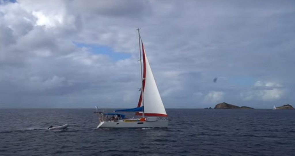
This route through the Caribbean is known as the ‘Thorny Path’ because it’s upwind all the way to the Leeward Islands. The good news is the further south you sail, the more favorable the sailing conditions will get. By the time you arrive in Antigua, the wind should be on the beam and it’s just a one day beam reach between islands all the way down to Trinidad.
From Trinidad, the wind is behind you all the way to Panama. Most sailors stop in the ABC islands (Aruba, Bonaire and Curacao) and Cartagena, Colombia before landing in Panama to explore the San Blas Islands and Bocas del Toro.
The next leg of the Caribbean circuit is north along the coast of Central America. You will want to keep well to windward of the Mosquito Coast (a dangerous lee shore), but San Andreas Island and Providencia Island both make for good stops on your way to the Bay Islands of Honduras.
There are a variety of places to explore on the final sail back to Florida. If your boat’s draft is 6 feet or less, you won’t want to miss Lago Isabela in Guatemala – a freshwater lake surrounded by jungle that is accessible via the navigable Rio Dulce. Then you can sail north along the coast of Belize and Mexico to Cancun, which is a perfect final stop before crossing over to Cuba or directly across the Gulf Stream to Florida, whichever you prefer.
This circuit is very doable in 6 or 7 months, but if you find yourself wanting to slow down there are many options available to wait out the hurricane season. Anywhere south of Grenada is considered outside the hurricane belt, including all of Trinidad, Venezuela, Colombia and Panama. The Rio Dulce is also known as an inexpensive yet secure place to wait out the hurricane season.
If you plan to remain in the Caribbean for the summer months, make sure to check with your insurance company before you leave. Some refuse to insure boats that stay, and others impose heavy fees on clients who do so.
Classic Westabout Circumnavigation Offshore Sailing Routes
In this section, we will explore the typical westabout sailing circumnavigation by way of the Panama Canal. For the purpose of this article, we will presume you are departing from the Caribbean, but the same routing could easily be adapted to apply to sailors who sail from Europe or either coast of North America.
A Whirlwind One Year Circumnavigation
This option is much too fast for most sailors, but it is certainly possible to circumnavigate in one year if you have a fast boat and a very determined crew.
Leaving Florida in January, you would transit the Panama Canal in February and cross to the South Pacific in March, arriving in Tahiti by April. The challenge of the next section of the voyage is to cross the entire South Pacific and Indian Ocean in six to seven months in order to arrive in South Africa by October. Then you would round the Cape of Good Hope in November and cross the South Atlantic directly to the Caribbean. This could get you back to Florida in under a year.
Voyages like this are certainly possible, but they don’t leave much time for enjoying the sights along the way. The advantage to this option is the ability to circumnavigate the world even if you only have one year available, and to get to sample a wide variety of countries around the world in a short period of time.
This voyage might not be for everyone, but if someone were to make the offer I would take it without second thoughts. For those who love to sail, circumnavigating is the ultimate challenge, and a voyage like this would certainly be worth it even confined to a strict schedule.
A Three Year World Cruise
Of course, most sailors who go through the expense and effort of preparing for a circumnavigation want to have some time to enjoy the stops along the way. A three year round-the-world sail gives you the opportunity to relax and get some serious adventuring in while still keeping to a semi-rigid schedule.
On this itinerary, you would leave Florida in November and transit the Panama Canal in January. By May, you would be in Tahiti, beginning your cruise of the South Pacific. This would give you plenty of time to arrive in New Zealand (or Australia, if you prefer) with three options for the cyclone season:
- To find work ‘down under’.
- Find a secure marina (there are lots of excellent options) and trade your boat for a camper van or RV for an antipodal road trip through NZ and Oz.
- Leave your boat here and fly home until April.
After crossing the vastest ocean on the planet and sailing nonstop for a full year, cyclone season presents the perfect opportunity to rest, catch up on work, and prepare your vessel for the next leg of the adventure: the Indian Ocean.
In April, get back on your boat and sail across the Tasman Sea, or up the Great Barrier Reef if you are already in Australia. After you round Cape York, you are in the Torres Strait, a region known for wildly fluctuating tides and currents. Once you have carefully navigated through this maze of islands and reefs, make your way to Darwin or Bali, either of which makes an ideal jumping off point to cross the Indian Ocean.
The most straightforward way across the Indian Ocean is by way of Cocos Keeling, Mauritius and Reunion Islands. If you are more adventurous, you can sail a more northerly route with a detour to the Chagos Islands and Madagascar.
Either way, you are likely to encounter rougher seas in the Indian Ocean. This part of the world has a well earned reputation for putting sailors heavy-weather sailing skills to the test. This is actually a good thing, because you will really want to make sure everything onboard is shipshape before reaching South Africa.
South Africa
On this schedule, you will plan to arrive in Durban, South Africa in October or November. This is the end of the safe sailing season in the Indian Ocean, but the start of the austral summer at the Cape of Good Hope.
South Africa is famous for challenging sailing conditions. The worst is caused when the west flowing Aghulas current collides with an opposing wind blowing up from the Southern Ocean. When this occurs over the shallow continental shelf, the result is massive breaking seas. In some cases, commercial freighters have broken in half because of the incredible size of the waves.
Fortunately for the cruising sailor, the worst of the weather can be avoided by careful weather routing. You will likely sail short passages from port to port along the South African coast until you get to Cape Town.
Now you are in the beautiful southernmost city in Africa, which is an excellent jumping off place for the final leg of your circumnavigation – crossing the South Atlantic Ocean back to the Caribbean.
The ideal goal in South Africa would be to arrive in Cape Town in time for Christmas and plan on crossing the Atlantic by January or February. This gives you plenty of time to stop at Saint Helena Island, and cruise the coast of Brazil before closing the circle in the Caribbean.
You may want to wait until November to make the final sail up the Caribbean Islands back to Florida in order to time your arrival with the end of the Atlantic hurricane season. Fortunately, there are no tropical storms in the South Atlantic, so you shouldn’t have to worry all the way from South Africa to Grenada.
Of course, with more time, one could plan endless variations of this route, with hundreds of detours and side trips. Some people take decades to sail around the world – and don’t regret it one bit.
The Suez Option
One notable variation on this route is to sail around Africa by way of the Suez Canal instead of South Africa. Due to the risk of piracy off Somalia and the political situation in the Middle East, less than ten percent of circumnavigators currently choose this route.
But if you are brave, and you understand the risks associated with sailing through this area, the Red Sea route opens up a fascinating and exotic part of the world for the intrepid sailor. There is reason to believe that Somalia and the Red Sea will be once again safe for cruisers in the very near future.
Southern Ocean Circumnavigation Offshore Sailing Routes
If a world cruise through the tropics sounds a little too tame, then a circumnavigation by way of the Southern Ocean (called ‘the south’ by Southern Ocean veterans) might be for you. This voyage is definitely only recommended for highly experienced sailors on seaworthy and proven vessels.
Ever since the first tall ships ventured into the watery wastes of the Southern Ocean, braving the dangers of the great southern sea has been considered the ultimate challenge in the world of sailing. At the age of 23, I delivered a 40 foot sailboat through the Southern Ocean, and I can say from first hand experience it’s no joke.
The Southern Ocean is the only place where weather systems can travel all the way around the world without land masses getting in the way to break them up. For this reason, the storms often become much more severe than in the rest of the world, and the waves are known to regularly reach unfathomable heights.
Vendee Globe or the Volvo Ocean Race
For many centuries, tall ship merchants used the strong prevailing winds in the Southern Ocean to deliver goods around the world at record speeds. Today, most who venture into the south are professional sailors taking part in a round the world race such as the Vendee Globe or the Volvo Ocean Race.
But every year, a few brave cruisers venture down into the southern seas on their own vessels purely for the fun of it, if such a word can apply to the Southern Ocean. Here we will discuss the sailing route for a cruising sailboat which aims to circumnavigate the world by way of the Five Great Capes in one season.
The Five Great Capes
The Five Great Capes are the southernmost points of Africa, Oceania and the Americas. From west to east, they are the Cape of Good Hope (Africa), Cape Leeuwin (Mainland Australia), SE Cape (Tasmania), SW Cape (New Zealand), and the most notorious of them all, Cape Horn (South America).
In 1969, the first nonstop sailing circumnavigation was completed in Falmouth by Sir Robin Knox Johnston, and to this day most round the world sailing races depart from either Britain or France. For this reason, in this section we will describe a Southern Ocean circumnavigation departing from Europe.
Offshore Sailing Routes
In order to arrive in the Southern Ocean when the weather is most favorable, most cruisers will need to depart by September or October. It’s over 8,000 NM to the Cape of Good Hope, which should take the average cruiser two months if the conditions are favorable.
Bay of Biscay to Portugal
The first challenge on such a voyage is crossing the Bay of Biscay. Many round the world sailors encounter their first gale here, and there is a good chance that the wind will be on the nose.
If you get to the coast of Portugal unscathed, you could make it all the way to the South Atlantic before you get to your first serious storm of the voyage. The sail from Portugal to the Equator is through the NE trades, so this part of the voyage is comparatively tame.
ITCZ to Coast of Brazil
The next challenge is the ITCZ, which we have discussed in further detail in a previous section. After crossing the Equator, you are again in the trade wind belt, but this time the wind is from the SE, directly from the Cape of Good Hope. Because it is impossible to sail straight into the wind, and to avoid the light airs of the South Atlantic High, the typical route around South Africa first passes south along the coast of Brazil. Most sailors only turn east once almost to 40 degrees south, which is the official start of the Southern Ocean.
South of 40 degrees, the prevailing winds are behind you again, but you will likely encounter a gale every 3 to 5 days. Your storm sails will definitely get plenty of use over the next twelve thousand miles!
Cape of Good Hope to Cape Leeuwin
It’s just under 5,000 NM from the Cape of Good Hope to Cape Leeuwin. The shortest route between the capes passes far to the south, but it’s a good idea to stay north of 45 degrees to avoid the worst of the weather and ice.
You don’t want to venture above 35 degrees north either because of the variable winds in the ‘horse latitudes’ (The horse latitudes are between 30 and 35 degrees south. They were so named because in the days of commercial sail, becalmed ships would throw horses over the side to lighten the load).
The entire passage between the Cape of Good Hope and Cape Horn is a race against the clock to get out of the Southern Ocean before the end of the southern hemisphere summer. You want to be well past the Horn by the end of March when the weather turns even more dangerous.
It’s a good target to round Cape Leeuwin before the end of January so that you have two months to cover the 7000 NM to Cape Horn. The ice limit in the Pacific is a little further south than the Indian or Atlantic Oceans, so once you pass New Zealand it’s usually safe to sail a little farther south. It’s a good target to stay between 45 to 50 degrees south for this part of the voyage.
Point Nemo
Halfway between New Zealand and Cape Horn is Point Nemo – the location on the planet that is farthest from any land. As you sail past this landmark, you are likely to be the most isolated human in the world.
Once past this Point Nemo, you will want to prepare for your descent toward Cape Horn, the Everest of the oceans.
Cape Horn
To round Cape Horn, you will have to pass 56 degrees south. You definitely don’t want to end up too far north and risk landfall on the coast of Chile, which is one of the most inhospitable lee shores in the world.
Cape Horn itself is only a few hundred miles from Antarctica. It is estimated that 10,000 sailors died trying to round the Horn in the age of sail. Cape Horn marks the pinnacle of any Southern Ocean circumnavigation, and fortunately, it’s usually much easier sailing from here on out.
South America
The sail up the Atlantic is similar to the passage on the way south, but in reverse. You should have a pleasant sail through the SE trades up the coast of South America, and then cross the ITCZ for the second time. Once in the NE trade winds north of the Equator, you will want to sail an arc to the west from the NE tip of Brazil to the Azores. This will help you get the best sailing angle for the grand finale back to Europe. After you pass the Azores, it’s simply a short downwind cruise to the English Channel and the finish line.
Congratulations – you just completed one of the most difficult challenges in the sailing world!
Arctic Offshore Sailing Routes
The most recent frontier to open up to cruising sailors is the Arctic. With the polar ice melting faster every year, the NW passage through Northern Canada is becoming more accessible to sailors and commercial vessels every year. If you are looking to sail to the ends of the earth but you want an entirely different experience than the Southern Ocean, a transit of the NW passage may be just the adventure for you.
When to Set Sail
The summer is short in the far north, and the ice free season is usually limited to just part of August and September. In order to take advantage of this brief window, you will need to be positioned at the entrance to the NW Passage by late July. Of course, to sail this part of the world you will need to be prepared to spend a lot of time waiting for the weather and ice.
If you are departing from the East Coast of Canada or Europe, it makes sense to leave in May or June and cruise the coast of Labrador or Greenland while you are waiting for the NW Passage to open up. This region is worth a summer of exploration on it’s own. I sailed this area in 2011, and it remains one of my favorite all time places to cruise in the world.
Once you have made your way through the NW Passage, winter will already be well on it’s way. You may want to be prepared to keep your boat in Alaska for the winter in order to avoid crossing the North Pacific Ocean in the stormy winter season.
Another interesting challenge for boating adventurers that is becoming more free of ice every year is the Northern Sea Route, or the NE Passage, over the top of Russia. At this time the greatest challenge for cruisers wanting to explore this area is obtaining a permit to cruise Russia. If you are lucky enough to get permission, this sail should be every bit as beautiful and challenging as the NW Passage in Canada.
Choosing the Right Offshore Sailing Route For You
The options for offshore sailing routes are as wide ranging as your own ambition and capabilities allow. It’s important to consider all the different factors when making up your mind about where you want to sail – like your budget, your long term schedule, and of course, the capabilities of your vessel and the experience of your crew. Once you have decided upon a route, the best way to prepare is read everything you can find about it and sail your boat as much as possible.
There are a few helpful resources to keep in mind when planning your future sailing adventure. Almost every offshore sailor has a copy of “World Cruising Routes” by Jimmy Cornell on their bookshelf. This book covers all the routes we discussed in this guide and it’s considered the ultimate bible for offshore sailors.
Make sure to subscribe to the SailAndProp.com newsletter for more tips to help you plan your sailing routes across the oceans. This is one of the best ways you can stay ahead of the wave when it comes to planning your next boating adventure – wherever the winds may take you!
My personal goal remains a circumnavigation of the world, which I plan to take on in several stages. Once my vessel’s refit is complete I will begin with a one year circuit of the Atlantic Ocean as a kind of extended sea trial. Then I will make any changes necessary to my boat and get my finances in order before leaving on a three year westabout circumnavigation.
I’m still delivering yachts all over the world, but I have never taken my eyes off the prize – a sailing voyage around the world. With proper planning and a solid understanding of offshore sailing routes I know that I can sail anywhere in the world.
And so can you.
As you prepare to sail across the oceans there is no better way to keep up on the latest boating information than on this site. We will be regularly publishing more articles on topics like offshore sailing routes, so sign up for our newsletter today to stay ahead of the wave.