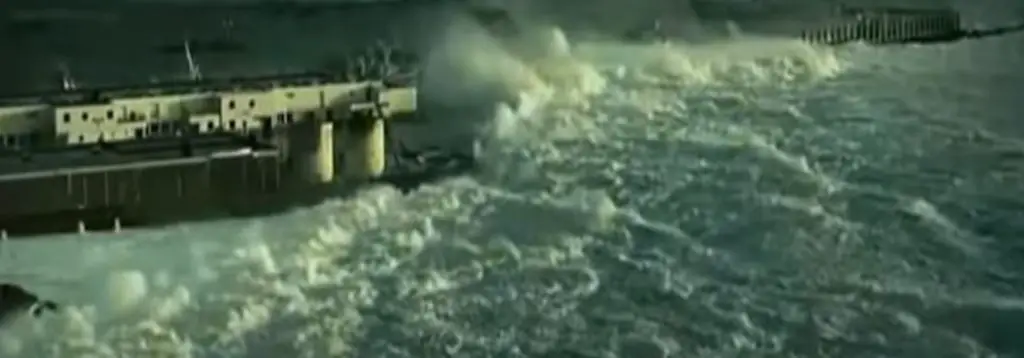
There is no greater challenge of offshore sailing routes in the world than to complete a voyage around the Five Great Capes. Here, deep in the Southern Ocean, waves can travel all the way around the world, building to unimaginable heights, and storms regularly reach an intensity rarely seen elsewhere on the planet.
But every year the remote isolation and incredible beauty of the Five Great Capes inspire brave navigators to throw off their bow lines and sail for the deep south. If you have ever dreamed of taking on the challenge of venturing to places like the Cape of Good Hope or Cape Horn, then read on. This guide is designed to help you plan and prepare for a voyage to this dangerous, yet incredibly rewarding part of the world.
Preparing For The Voyage
The most important part of preparing for a voyage to the ends of the earth is to make sure that you have a vessel that is ready to take on some of the most wild seas on the globe. Before making the decision to sail here, you should have a well found vessel that has been tested in all conditions, extremely well maintained, and a crew that is highly experienced in high latitude offshore boating.
Some of the sailing routes that would make for an excellent trial run for the Southern Ocean, like an Atlantic Circuit or a westabout circumnavigation via the Panama Canal, can be found in our previous article “The Ultimate Guide to Offshore Sailing Routes”. If you have taken on boating in the trade winds and are looking for more, a voyage around the Five Great Capes could make for the adventure of a lifetime.
The Offshore Sailing Routes for the Five Great Capes
About 90% of sailors making a voyage around the Five Great Capes depart from Europe, sailing down the Atlantic, and then eastabout around the southern hemisphere. This route takes advantage of the strong prevailing winds and currents in the Southern Ocean to make for a fast and wild downwind ride all the way around the world. For the sake of the article, the guide is designed for a sailor who plans to depart from the North Atlantic, although one could use the same guide to plan for a voyage around the Great Capes departing from any port along the route, adjusting their voyage schedule accordingly.
The Cape of Good Hope
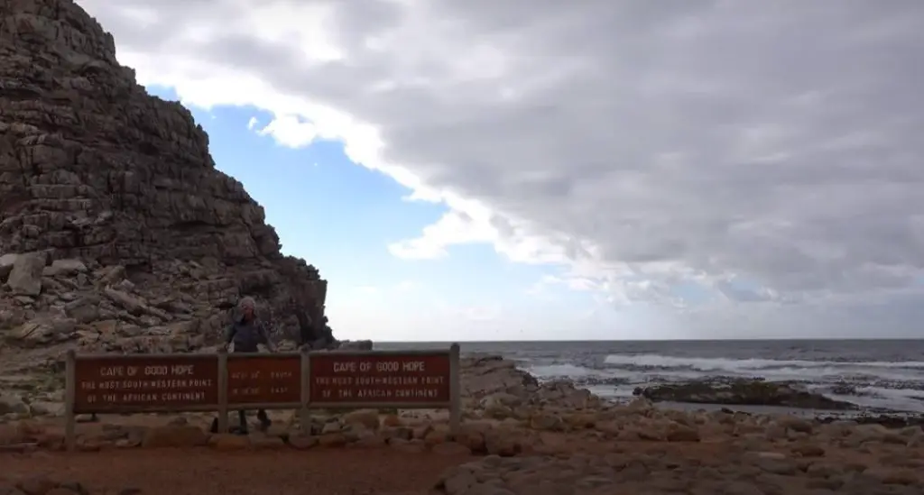
Departing from Europe on a eastabout voyage around the Great Capes, the first cape you will encounter is the Cape of Good Hope at the bottom of Africa. It is a common misconception that the Cape of Good Hope is the Southernmost point in Africa, but that honor goes to the much less known Cape Agulhas, a short distance to the Southeast.
Recent discoveries suggest that Chinese Junks as well as Greek and Egyptian navigators rounded the Cape of Good Hope thousands of years ago, but the first European to reach the Southern Cape of Africa was the Portugese explorer Bartolomeu Dias, who named it “The Cape of Storms”. John II of Portugal later changed the name to the Cape of Good Hope to give storm-weary sailors a little optimism as they made their way through these storm tossed seas. The Cape soon became the primary landmark on the most important sailing trade route in the world at that time, between Europe and the far East.
The South Atlantic High
The South Atlantic High, simply referred to as “the high” by sailors in this region, is a semi-permanent stationary high pressure system that usually sits about 500 to 1,000 nm east of Cape Town. Inside the high, the weather is calm but there is rarely enough wind to sail.
Due to the position of the South Atlantic High a route from Europe directly to the Cape of Good Hope would require sailors to beat into headwinds for over 3,000 nautical miles and risk getting becalmed in the high itself. In order to circumvent this problem, the usual route to South Africa passes south along the coast of Brazil and then as far south as the edge of the Southern Ocean (the official boundary for the Southern Ocean is 40 degrees South) before turning east towards South Africa.
Many sailors on their way around the world choose to stay far south of the Cape of Good Hope itself in order to take advantage of the most favorable winds and avoid the rocks and reefs found close to the Cape.
Fortunately, you don’t have to actually pass close enough to see the Cape to officially round it. But for those who want to explore the coastline of South Africa, or stop at one of the world famous ports like Cape Town or Durban, you will need to be prepared for some of the most difficult navigation in the world.
The Cape of Good Hope happens to be located where the warm west flowing Aghulas current collides with the cold, low pressure storms of the Southern Ocean. When these two forces of nature meet over the shallow African continental shelf, the resulting seas are massive, steep, and very confused. These waves can get so dangerous that even ocean going freighters have on occasion broken in half due to the unimaginable height of the swells.
Dangerous Waters
For the captains of the tallships that plied these waters centuries ago, these horrendous conditions meant that rounding the Cape could sometimes take months. Often, the ships never made it, either falling victim to the storms offshore or breaking apart on the unforgiving rocks along the coast.
Fortunately for the contemporary navigator, modern day weather forecasting and satellite imagery makes it possible to avoid the worst of the weather along this stretch of coast. There are numerous ports along the South African coast – like Cape Town, Port Elizabeth and Durban, among others – where you can wait for the ideal conditions to continue your voyage along South Africa.
Most recently, the importance of the route around the Cape of Good Hope was highlighted when a large freighter, blown sideways by the wind, was wedged into land on both sides of the Suez Canal, thus halting the passage for ships waiting to transit. Instead of waiting for days or weeks for the canal to be freed, many of these stranded ships opted to alter their route and sail around the Cape of Good Hope.This added thousands of miles to their voyages, and put them at the mercy of the “Cape of Storms”.
Cape Leeuwin
Leaving South Africa, the next Great Cape to the east is Cape Leeuwin, the southwestern point of Australia. If you want to make it all the way around the Great Capes in one season, it is important to depart South Africa by December in order to make it around Cape Horn before the start of the austral winter.
The sail across the South Indian Ocean can be rough, and there are no potential stops along the way, so a short detour up the coast to Perth may be a good idea for supplies and rest.
Perth, Australia
Perth has its own important chapter in the sagas of the Great Capes. It was an important port of call for many of the Clipper Ships that delivered goods between Europe and Australia, and it’s the home port to numerous world famous modern day sailors like David Dicks and John Sanders.
Dicks, at just 18 years of age, was the first young sailor to circumnavigate the world nonstop by way of the Five Great Capes, and Sanders, who was his mentor, is the only person to sail around the world three times without stopping. Now over 80 years old, Sanders is currently on his tenth voyage around the world.
Cape Leeuwin is located at only 34 degrees south of the equator, so it’s not nearly as far south as some of the other Great Capes like Cape Horn. But it still gets its share of the wild and windy weather that dominates all of the Southern Ocean. Leeuwin was known by the Aboriginal name “Doogalup” by the native inhabitants of the region, but it was later renamed Cape Leeuwin by the English sailing captain Matthew Flinders after a Dutch ship that had charted much of this coastline some years before. After naming the Cape, Flinders anchored at a nearby bay which he later christened Flinders Bay.
Great Australian Bight
Anyone sailing through the region will want to carefully study the weather patterns for the Great Australian Bight, the stretch of sea between Cape Leeuwin and Tasmania. You can expect to encounter a gale here every three to five days as the low pressure systems sweep across the Southern Ocean. There are few secure ports along this stretch of coastline, so you will need to be ready to take a real beating at sea in case you aren’t able to make it to port in between storms. Like any of the Great Capes, modern weather forecasting is your best friend as you plan a voyage around Cape Leeuwin.
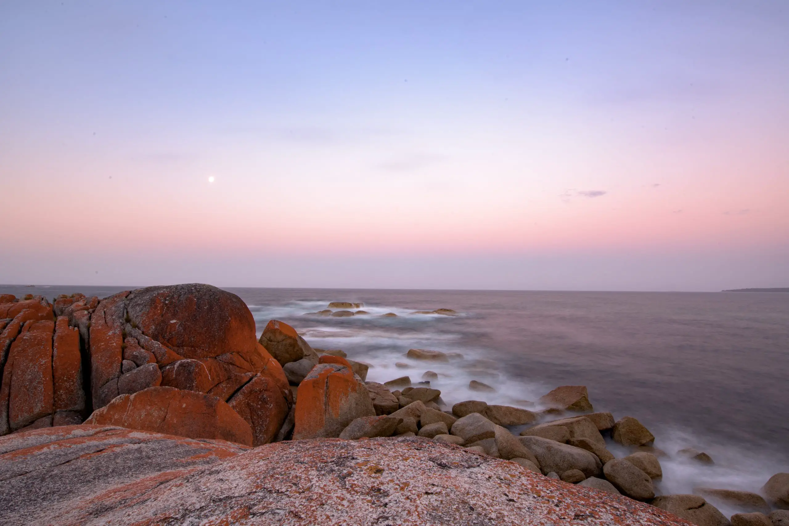
Southeast Cape
1500 nautical miles to the east of Cape Leeuwin is Southeast Cape, the southernmost point of Tasmania. Southeast Cape is a few hundred miles closer to Antarctica than Cape Leeuwin, and the weather here is often much worse. Possible ports to seek shelter on the passage from Cape Leeuwin include Augusta, Esperance, Adelaide, Port Lincoln, Portland and Melbourne.
Tasmania
Once you cross Bass Strait and reach the West Coast of Tasmania, the landscape becomes much more rugged, and there are few ports from which to seek refuge or find supplies. Those that are available, like Strahan or Port Davy, are very remote outposts with limited supplies available. However, this part of Tasmania is incredibly pristine wilderness and it’s beauty makes up for the lack of comforts. Tasmania is entirely different from the rest of Australia, with mountains taking up much of the interior and there are trees that rival the Redwoods in height. Here are a number of national parks and wildlife refuges.
If you are looking for isolation and wild beauty, this is an excellent place to venture.
The mountainous landscape around Southeast Cape means that it is often affected by katabatic winds. It is quite common to have the wind strength recorded around the Cape itself to be twice the speed of wind only a few miles out to sea.
Fortunately there are a number of safe ports available once you have made your way past the Cape. The most popular of them is Hobart, the largest city in Tasmania and home to the finishing line for the best known boating competition in the Southern Hemisphere – the famous Sydney-Hobart Yacht Race. Every year between Christmas and New Years, some of the best trained crews in the world take on the race from Sydney down to Tasmania. It’s well known that often less than half of the entrants finish the race, proof of the difficult and dangerous sailing in this part of the world.
Southwest Cape
900 nautical miles across the Tasman Sea from Southeast Cape at the far southern end of New Zealand is Southwest Cape. Southwest Cape is the southern tip of Stewart Island, the third largest island in New Zealand and famous as the last refuge for the strange Kiwi bird, the animal that gives Kiwis (citizens of New Zealand) their name. This unusual bird, which is mostly nocturnal and cannot fly, is helpless against the dogs, rats, cats and other non-native predators that nearly drove it extinct on the mainland. Conservationists have worked hard to keep Stewart Island free of these invasive species, and tourists travel to Stewart Island from all over the world to try to spot the elusive bird.
New Zealand Customs and Immigration
Because of their long history dealing with the effects of invasive species, New Zealand has one of the most strict entry procedures of any country in the world. All boats are required to report to customs via radio at least 48 hours prior to arrival in the country. If your vessel is not equipped with a long range radio, you will want to take this requirement into consideration as you plan your landfall in New Zealand.
Customs and immigration officials will meet you at the customs dock at the designated time and go over your vessel to deem it safe for entry. You can expect the officials to carefully inspect all of your food, including boxed and canned goods to make sure you don’t have a potential seed or unwanted pest onboard. You can also expect to hand over all of your garbage to be destroyed. In many cases, the officials will inspect your vessel’s underside for barnacles or seaweed and fumigate the interior if they suspect bugs.
Port of Entry: Bluff
The closest port of entry to Southwest Cape is Bluff, a small town located on a tiny peninsula at the far southern end of the South Island of New Zealand. This is where the ferry departs and brings tourists to Stewart Island. It is also from the South Island where some ships leave for Antarctica or the Sub-Antarctic Islands like Campbell Island or Auckland Island. Southwest Cape is, after all, the closest Great Cape to Antarctica besides Cape Horn.
As you approach landfall on the South Island, you will want to be wary of the many offshore rocks and small islands, as well as strong currents in the Foveaux Strait. Bluff has a small port and basic supplies are available, but if you need serious work done after the passage across the Tasman Sea, you may need to travel to Auckland or the Bay of Islands on the North Island. This part of New Zealand is one of the world’s best cruising meccas and everything a boater could need is readily available. New Zealanders are famous around the world for their love of boats and Auckland is often referred to as the city of sails. There is a reason that New Zealand often wins against much larger countries at boating competitions like the America’s Cup yacht race.
Fiordland
For the more adventurous sailor, a detour to Fiordland on the west coast of the South Island would be well worth a few weeks exploration. This area, famous for the steep mountainsides plunging directly to the sea from the snow capped peaks, is one of the most awe inspiring places in the world and is rarely visited by cruising vessels.
Prior to departing New Zealand you will want to make sure you are well prepared for the longest passage on this route – 5,000 miles nonstop to Cape Horn, the greatest Cape of them all.
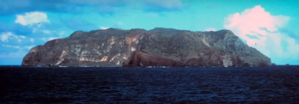
Cape Horn
If you are keeping to the schedule of rounding all Five Great Capes in one season, you will want to plan to depart New Zealand by early February. This should give you ample time to make it around Cape Horn before late March when the weather worsens drastically.
Point Nemo, If You Dare
This leg of the voyage will take you past Point Nemo, the point on the planet that is farther from land than anywhere else in the world. Here, with New Zealand behind you, Chile to the west, tiny Pitcairn Island to the north, and Antarctica to the south, chances are you will be the most isolated person on the planet.
There are no stops between New Zealand and Cape Horn, and busy shipping routes are hundreds of miles away, so anyone who sails here must be prepared to tackle any emergency on their own.
As you approach Cape Horn, it will be important to avoid the dangerous lee shore on the Patagonian coast of Chile. If you wait too long to turn south, you could end up dangerously close to this rocky and weather beaten coastline. Cape Horn is located at almost 56 degrees south of the equator, so you will want to turn south once you are approximately 1,000 nautical miles from the Cape. It’s best to keep at least 300 nautical miles off the Chilean coast to give yourself enough space to escape any unexpected gales. .
Once you have reached 56 degrees south, then it’s safe to turn due east and make your way around the Cape itself. The Horn is only a few hundred miles away from Antarctica, and at these latitudes you will need to keep a watch out for ice. A radar will be very useful here to help you keep a close look out.
Dangers of Cape Horn
At the time of it’s discovery in 1615, European explorers had been searching for a route between Europe and the Indies that didn’t require sailing around the Cape of Good Hope or the Strait of Magellan, which were both controlled by the Dutch. For many years, Tierra del Fuego, the large island north of Cape Horn, was widely believed to be part of a larger southern continent. The discovery of Cape Horn, and the Drake Passage to the south of it, opened up an entirely new trade route between Europe and the East.
Unfortunately, that new route came with some serious challenges. The rough weather, poor visibility, freezing temperatures and massive seas that were part of every voyage around Cape Horn meant that many people never made it. Over 10,000 sailors were estimated to have lost their lives trying to make their way around the infamous Cape, each of which is said to now be reborn as a wandering albatross. Surviving the passage around the Horn was always the most difficult part of a circumnavigation for the clipper ships, and it still is for contemporary sailors following in their wake.
For many centuries, the seas around Cape Horn were some of the busiest in the world, despite the danger in voyaging through those waters. But the opening of the Panama Canal in 1914 redirected almost all of that traffic north to warmer and safer waters. Today, Cape Horn is left to the few ships that are too large to make their way through the Panama Canal, and a handful of brave sailors who venture deep into the wastes of the Southern Ocean to experience for themselves the challenge of the Everest of the oceans.
Final Thoughts
A voyage to the Five Great Capes is no easy undertaking. But if you are one of the lucky few boaters who gets the opportunity to test your skills in the Southern Ocean, the experience will be with you for the rest of your life. I will never forget my time spent sailing around the Great Capes, and I dream of returning to this incredible part of the world. With a solid ship, a good crew, and a lot of determination, you too can sail to the ends of the earth.
As you plan your future boating adventures there is no better place to find quality information than right here at SailAndProp.com. We will be publishing more guides regularly on destinations like the Five Great Capes, so don’t forget to sign up to our newsletter to get the latest info sent right to your inbox.